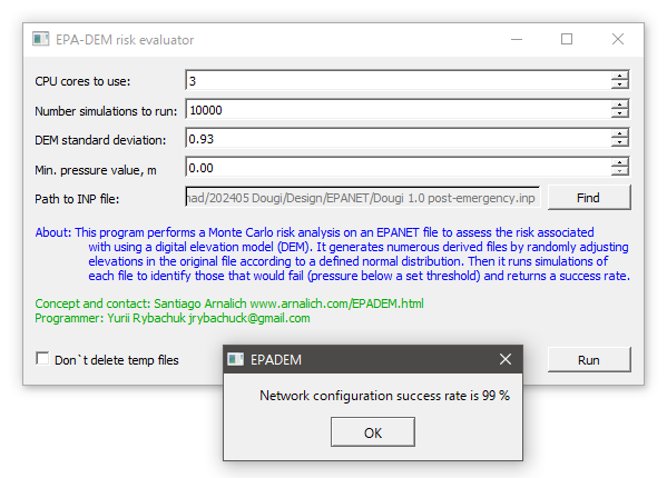
EPA-DEM is free and
open-source program that enables rapid water supply
planning in humanitarian crisis. It evaluates the risk
of using elevations obtained from commonly available
digital elevation models (DEM) in hydraulic calculations
performed with EPANET.
Download
Standard deviation parameter
If you don't
have a value for your country or region, use 0.9
for FABDEM.
So far we have
calibrated over 50.000 points in the following
countries:
| FABDEM 1.2 | SRTM | |
| Chad | 0.93 | 1.84 |
| Ethiopia | 0.59 | 1.80 |
| Jordan | 0.58 | 1.43 |
| South Africa | 1.70 | 3.18 |
| South Soudan | 0.74 | 1.30 |
| Sudan | 0.61 | 1.04 |
| Zimbabwe | 0.74 | 7.93 |
You
can submit professional grade topographic data using contact@arnalich.com.
Interpreting results
Success values
above 95% are low risk.
Values below 95%
are risky.
Read the manual
for more nuance.
Video tutorial
© Santiago Arnalich
2002-2009
Sitemap